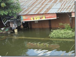
Bangkok Flooding Update and Evacuation
October 20, 2011
3:30 p.m. Local Time
Bangkok, Thailand
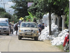
I drove around today to monitor the flooding situation. I did not get far heading for the front lines near Don Mueang Airport; there was too much traffic, and many lanes have been blocked by people who parked their vehicles on the road where they’re less likely to be submerged. I turned back after sitting in traffic for an hour.
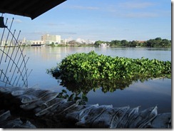
Along the way, I observed a swollen canal and a bloated Chao Phraya River not far from here. The situation looks tenuous and could go either way – either the water will flow fast enough to empty into the Gulf of Thailand, or it will soon spill over into Bangkok’s neighborhoods. I can’t tell, and we aren’t taking any chances. If we stay here, we risk being blocked by water hazards and closed roads.
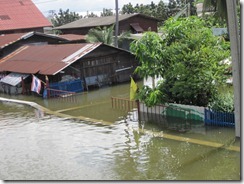
As a safety precaution, we’ve decided to evacuate our home tonight and head to downtown Bangkok for shelter. We’ve put up everything we could on upper level of our home in case it’s flooded. I’ve heard unofficially that homes that have flooded have between 1/2 and 1-1/2 meters of standing water.
We had planned to go to the Golden Triangle (Lao-Burmese-Thai tri-border) this weekend for a brief vacation, but those plans are still awaiting update on the flood situation. We aren’t going anywhere if we can’t get to the airport.
October 21, 2011
8:30 a.m. Local Time
Bangkok, Thailand
We made it safely to Bangkok and are staying in a hotel. We’ll be here until tomorrow and will head to the Golden Triangle (Chiang Rai) as planned. I heard that the flooding was reached one of the key thoroughfares in Nonthaburi, Chaengwatthana Road, but this is unconfirmed. If water rises more than one to 1.5 meters above the road, the water will spread to our area.
I took lots of peoples and some video, and will post them online soon.

